


Garmin· All Garmin Sports & Handheld GPS →
Garmin GPSMAP 62 Handheld GPS Navigator
See current price
Check the current price and availability on Amazon.com.
View on AmazonAffiliate link — we may earn a commission at no extra cost to you. Learn more
- Item Weight
- 9.2 Ounces
- Item model number
- 010-00868-00
- Batteries
- 2 AA batteries required. (included)
- RAM
- 1724 MB
Key features
- 2.6-inch TFT LCD display
- Rugged, waterproof navigator, sunlight-readable, 65-K color with 160 x 240 pixel resolution. Built-in worldwide basemap with shaded relief; add a wide array of detailed topographic, marine and road maps
- Supports BirdsEye Satellite Imagery (subscription required) for integrating satellite images with your maps
- Supports geocaching GPX files for downloading geocaches and details straight to your unit
- Explore routes uploaded by millions of Garmin Connect users and share your experiences on Twitter and Facebook
- 2.6 in. transflective, 65-K color TFT display
- Rugged, waterproof navigator with 2.6-inch, sunlight-readable, 65-K color TFT screen and 160 x 240 pixel resolution
- Built-in worldwide basemap with shaded relief; add a wide array of detailed topographic, marine and road maps
- Supports BirdsEye Satellite Imagery (subscription required) for integrating satellite images with your maps
- Supports geocaching GPX files for downloading geocaches and details straight to your unit
- Explore routes uploaded by millions of Garmin Connect users and share your experiences on Twitter and Facebook
Specifications
| Product Dimensions | 6.3 x 1.4 x 2.4 inches |
|---|---|
| Item Weight | 9.2 Ounces |
| Item model number | 010-00868-00 |
| Batteries | 2 AA batteries required. (included) |
| RAM | 1724 MB |
| Special features | Transflective screen, Barometric altimeter, Garmin Connect compatible, Custom POIs, Hunt/fish calendar, Geocaching, Photo navigation |
| Other display features | Wireless |
| Human Interface Input | Touchscreen |
| Department | GPS -> GPS NAVIGATION |
| Manufacturer | Garmin |
| Brand | Garmin |
| Screen Size | 2.6 Inches |
| Special Feature | Transflective screen, Barometric altimeter, Garmin Connect compatible, Custom POIs, Hunt/fish calendar, Geocaching, Photo navigationTransflective screen, Barometric altimeter, Garmin Connect compatible, Custom POIs, Hunt/fish calendar, Geocaching, Photo navigation See more |
| Map Type | North America |
| Battery Life | 20 Hours |
| Mounting Type | Dashboard Mount, Found in image |
| Item Dimensions LxWxH | 6.3 x 1.4 x 2.4 inches |
| Memory Storage Capacity | 1724 MB |
| Year | 2010 |
| ASIN | B004I6CYXI |
About this product
Product Description The newly designed GPSMAP 62 handheld navigator features a 2.6" sunlight-readable 65K color screen that supports BirdsEye Satellite imagery (subscription required) and Custom Maps. Rugged and waterproof, GPSMAP 62 features a quad helix antenna for unparalleled reception and sleek new design. Amazon.com The newly designed GPSMAP 62 handheld navigator features a 2.6" sunlight-readable 65K color screen that supports BirdsEye Satellite imagery (subscription required) and Custom Maps. Rugged and waterproof, GPSMAP 62 features a quad helix antenna for unparalleled reception and sleek new design. Rugged and waterproof, GPSMAP 62 features a quad helix antenna for unparalleled reception and sleek new design. Built-in worldwide basemap with shaded relief. The perfect companion for all your outdoor pursuits. Download geocaches and details straight to your unit. Beloved by Hunters, Hikers, and Geocachers of All Ages Explore GPSMAP 62 comes with built-in worldwide basemap with shaded relief, so you can navigate anywhere with ease. With photo navigation, you can download pictures from Garmin Connect Photos and navigate to them. Keep Your Fix With its quad helix antenna and high-sensitivity, WAAS-enabled GPS receiver and HotFix satellite prediction, GPSMAP 62 locates your position quickly and precisely and maintains its GPS location even in heavy cover and deep canyons. The advantage is clear--whether you're in deep woods or just near tall buildings and trees, you can count on GPSMAP 62 to help you find your way when you need it the most. Add Maps Adding more maps is easy with Garmin's wide array of detailed topographic, marine and road maps. With 1.7G of onboard memory, you can conveniently download 24K and 100K topo maps and hit the trail, download BlueChart g2 for a great day on the water or City Navigator NT map data for turn-by-turn routing on roads (see maps tab for compatible maps). GPSMAP 62 also supports BirdsEye Satellite Imagery (subscription required), that lets you download satellite images to your device and integrate them with your maps. In addition, the 62 is compatible with Custom Maps, free software that transforms paper and electronic maps into downloadable maps for your device. Get Connected You've been busy exploring and now you want to store and analyze your activities. With a simple connection to your computer and to the Internet, you can get a detailed analysis of your activities and send tracks to your outdoor device using Garmin Connect. This one-stop site offers an activity table and allows you to view your activities on a map using Google Earth. Explore other routes uploaded by millions of Garmin Connect users and share your experiences on Twitter and Facebook. Getting started is easy, so get out there, explore, and share. Find Fun GPSMAP 62 supports geocaching GPX files for downloading geocaches and details straight to your unit. By going paperless, you're not only helping the environment but also improving efficiency. GPSMAP 62 stores and displays key information, including location, terrain, difficulty, hints and descriptions, which means no more manually entering coordinates and paper print outs! Simply upload the GPX file to your unit and start hunting for caches. Slim and lightweight, 62 is the perfect companion for all your outdoor pursuits. What's in the Box GPSMAP 62, Wrist Strap, USB Cable, Quick Start Manual
Similar products
Compare all Garmin Sports & Handheld GPS →
Garmin
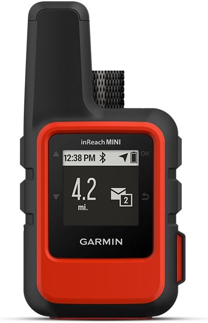
Garmin 010-01879-00 InReach Mini, Lightweight and Compact Satellite Communicator, Orange
See current price
See current price