


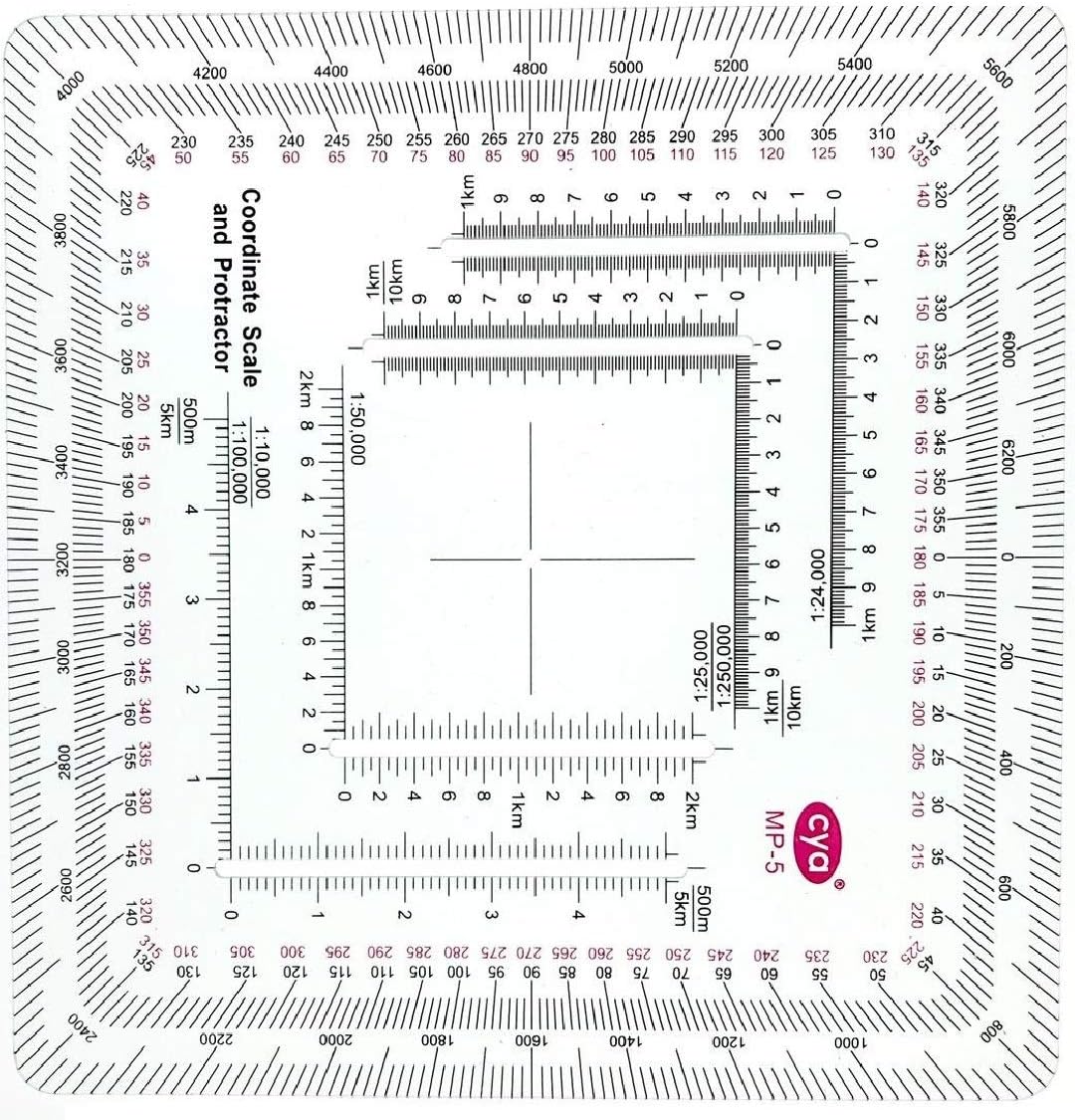
Gotical New and Improved Version Military Style MGRS/UTM Coordinate Grid Reader, and Protractor,Coordinate Scale Map Reading and Land Navigation Topographical Map Scale
See current price
Check the current price and availability on Amazon.com.
View on AmazonAffiliate link — we may earn a commission at no extra cost to you. Learn more
- Package Weight
- 0.02 Kilograms
- Brand Name
- Gotical
- Color
- Pack of 1
- Manufacturer
- Gotical
Key features
- The tool is printed on plastic stock about the thickness and stiffness of a credit card, with a protective coating. It's 33% thicker than the standard military issue version, so it's less likely to be bent or broken when you need to use it.
- Rounded corners keep it from wearing holes in your pockets.
- Includes 1:24,000 scale for USGS 7.5 minute topographic maps.
- Larger 1:50,000 and 1:100,000 scale rulers for maps with wider grid spacing.
- Height: 4.75 in. (120mm) Width: 4.75 in. (120mm) Thickness: 0.030 in. (1mm)
Specifications
| Item Package Dimensions L x W x H | 2.95 x 2.56 x 0.28 inches |
|---|---|
| Package Weight | 0.02 Kilograms |
| Brand Name | Gotical |
| Color | Pack of 1 |
| Manufacturer | Gotical |
| Part Number | RUL2 |
| ASIN | B0BHPRMQFX |
About this product
Scales: 1:10,000 x 500m 1:24,000 x 1km 1:25,000 x 1km 1:50,000 x 2km 1:100,000 x 5km 1:250,000 x 10km 1:500,000 x 20km This scale can be used by multiplying or dividing one of the scales printed on the tool by 10. For example, a 1:100,000 x 10km tool can be used as a 1:10,000 x 1km tool by dividing the scale and grid distance by 10, and as a 1:1,000,000 x 100km tool by multiplying the scale and grid distance by 10.
Similar products

Scotch
Scotch Heavy Duty Shipping Packaging Tape, 2 x 800 - Clear (3 Tapes) (1, Clear)
See current price

See current price